A4.1. Getting MODIS URLs
Access to MODIS data is now through http, which means that previous methods using ftp no longer operate.
In some ways, this complicates automatic download (also, download seems now to be throttled, which means it takes longer to access the data).
That said, you can of course still easily order data through NASA tools such as reverb.
Some tools have been developed to allow automated access to MODIS products from Python, such as get_modis, but here, we will demonstrate how you can do it yourself, semi-automatically.
We will see that a large part of the overhead and complexity is negotiating the directory structure.
We have provided a shell programme zat that will produce a list of urls of the MODIS products on the USGS server (use zat > urls.txt), which you would probably find more convenient than this section.
So, only go through section A1 if you are particularly intererested in trawling directories with http ...
Once we have a full list of the urls of the hdf files that we want, life is much simpler. Such a list of urls is exactly what reverb supplies you with.
A4.1.1 Identify the server and directory structure
First, you need to identify which datasets you want. You should explore the data products e.g. through reverb to do this.
If you go through the ordering system for one tile of these products, you can get the information you need for further data download. When you come to order the data, it will give you a download file.
As an example:
- MODIS LAI/fAPAR for Trerra and Aqua 8 day composite for 17 Jan 2013 for tile h18v03
A4.1.2 Identify the available dates
From this, we see that the server is e4ftl01.cr.usgs.gov, that the hdf data (the spatial dataset we want) for the product MCD15A2 version 005 is in the directory MODIS_Composites/MOTA/MCD15A2.005.
Below that, we have the date and then the filename.
Let's use urllib2 to explore this:
import urllib2
url_base = 'http://e4ftl01.cr.usgs.gov/MODIS_Composites/MOTA/MCD15A2.005'
response = urllib2.urlopen(url_base)
html = response.read()
# print the first 30 lines
html.split('\n')[:30]
This is an html directory listing. We can identify the directories as lines that contain [DIR].
We can use find to identify lines that have this field:
dirs = []
for line in html.split('\n'):
    if line.find('[DIRS]'):
        dirs.append(line)
# or more succinctly
dirs = [line for line in html.split('\n') if line.find('[DIR]') != -1]
dirs[:3]
We notice that the first such line is the directory listing information, so, what we really want is:
dirs = [line for line in html.split('\n') if line.find('[DIR]') != -1][1:]
dirs[:3]
The subdirectory name is jusr after the field href=":
print dirs[1]
print dirs[1].split('href="')[1]
print dirs[1].split('href="')[1].split('/">')[0]
So, in this case, we can get the subdirectory names with:
dirs = [line.split('href="')[1].split('/">')[0] for line in html.split('\n') if line.find('[DIR]') != -1][1:]
# print the first 10
dirs[:10]
The pattern is YYYY.MM.DD. So we could split these as we go along. It would be convenient to have this as a numpy array:
dirs = np.array([line.split('href="')[1].split('/">')[0].split('.') \
                 for line in html.split('\n') if line.find('[DIR]') != -1][1:])
dirs[:10]
all_years = np.sort(np.unique(dirs[:,0]))
all_months = np.sort(np.unique(dirs[:,1]))
all_doys = np.sort(np.unique(dirs[:,2]))
years,months,doys
A4.1.3 Identify the datasets
We know the full url is of the form:
http://e4ftl01.cr.usgs.gov/MODIS_Composites/MOTA/MCD15A2.005/2013.01.17/MCD15A2.A2013017.h18v03.005.2013026065052.hdf
Simplifying what we did above:
import urllib2
url_base = 'http://e4ftl01.cr.usgs.gov/MODIS_Composites/MOTA/MCD15A2.005'
response = urllib2.urlopen(url_base)
dirs = np.array([line.split('href="')[1].split('/">')[0] for line in html.split('\n') if line.find('[DIR]') != -1][1:])
years = np.array([i.split('.')[0] for i in dirs])
# year mask
year = '2012'
mask = (year == years)
sub_dirs = dirs[mask]
print sub_dirs
# test with first one
this_date = sub_dirs[0]

url_date = url_base + '/' + this_date
print url_date
response1 = urllib2.urlopen(url_date)
html1 = response1.read()
# print the first 21 lines
html1.split('\n')[:21]
We note that the directory contains data for all tiles.
Lets filter only lines that have the tile we want in:
tile = 'h18v03'
lines = [line for line in html1.split('\n') if line.find(tile) != -1]
lines
We want the .hdf file, so refine the filter:
tile = 'h18v03'
hdf_lines = [i for i in [line for line in html1.split('\n') \
                         if line.find(tile) != -1] if i.find('.hdf"') != -1]
hdf_lines
Now split this to get the filename we want:
hdf_lines[0].split('<a href="')[1]
hdf_lines[0].split('<a href="')[1].split('">')[0]
So, putting all of that together:
tile = 'h18v03'
hdf_lines = [i for i in [line for line in html1.split('\n') \
                         if line.find(tile) != -1] if i.find('.hdf"') != -1]
hdf_file = hdf_lines[0].split('<a href="')[1].split('">')[0]
A4.1.4 Some code for MODIS LAI filenames for a year
The http access is quite slow, so this may take some minutes to run.
year = '2012'
tile = 'h17v03'


hdf_files = []

import urllib2

# base URL for the product
url_base = 'http://e4ftl01.cr.usgs.gov/MODIS_Composites/MOTA/MCD15A2.005'

response = urllib2.urlopen(url_base)
html = response.read()

dirs = np.array([line.split('href="')[1].split('/">')[0] for line in html.split('\n') if line.find('[DIR]') != -1][1:])

# identify years
years = np.array([i.split('.')[0] for i in dirs])
# year mask
mask = (year == years)
sub_dirs = dirs[mask]

for this_date in sub_dirs:
    url_date = url_base + '/' + this_date
    print url_date
    response1 = urllib2.urlopen(url_date)
    html1 = response1.read()
    hdf_lines = [i for i in [line for line in html1.split('\n') \
                             if line.find(tile) != -1] if i.find('.hdf"') != -1]
    hdf_file = url_date + '/' + hdf_lines[0].split('<a href="')[1].split('">')[0]
    hdf_files.append(hdf_file+'\n')
http://e4ftl01.cr.usgs.gov/MODIS_Composites/MOTA/MCD15A2.005/2012.01.01
http://e4ftl01.cr.usgs.gov/MODIS_Composites/MOTA/MCD15A2.005/2012.01.09
http://e4ftl01.cr.usgs.gov/MODIS_Composites/MOTA/MCD15A2.005/2012.01.17
http://e4ftl01.cr.usgs.gov/MODIS_Composites/MOTA/MCD15A2.005/2012.01.25
http://e4ftl01.cr.usgs.gov/MODIS_Composites/MOTA/MCD15A2.005/2012.02.02
http://e4ftl01.cr.usgs.gov/MODIS_Composites/MOTA/MCD15A2.005/2012.02.10
http://e4ftl01.cr.usgs.gov/MODIS_Composites/MOTA/MCD15A2.005/2012.02.18
http://e4ftl01.cr.usgs.gov/MODIS_Composites/MOTA/MCD15A2.005/2012.02.26
http://e4ftl01.cr.usgs.gov/MODIS_Composites/MOTA/MCD15A2.005/2012.03.05
http://e4ftl01.cr.usgs.gov/MODIS_Composites/MOTA/MCD15A2.005/2012.03.13
http://e4ftl01.cr.usgs.gov/MODIS_Composites/MOTA/MCD15A2.005/2012.03.21
http://e4ftl01.cr.usgs.gov/MODIS_Composites/MOTA/MCD15A2.005/2012.03.29
http://e4ftl01.cr.usgs.gov/MODIS_Composites/MOTA/MCD15A2.005/2012.04.06
http://e4ftl01.cr.usgs.gov/MODIS_Composites/MOTA/MCD15A2.005/2012.04.14
http://e4ftl01.cr.usgs.gov/MODIS_Composites/MOTA/MCD15A2.005/2012.04.22
http://e4ftl01.cr.usgs.gov/MODIS_Composites/MOTA/MCD15A2.005/2012.04.30
http://e4ftl01.cr.usgs.gov/MODIS_Composites/MOTA/MCD15A2.005/2012.05.08
http://e4ftl01.cr.usgs.gov/MODIS_Composites/MOTA/MCD15A2.005/2012.05.16
http://e4ftl01.cr.usgs.gov/MODIS_Composites/MOTA/MCD15A2.005/2012.05.24
http://e4ftl01.cr.usgs.gov/MODIS_Composites/MOTA/MCD15A2.005/2012.06.01
http://e4ftl01.cr.usgs.gov/MODIS_Composites/MOTA/MCD15A2.005/2012.06.09
http://e4ftl01.cr.usgs.gov/MODIS_Composites/MOTA/MCD15A2.005/2012.06.17
http://e4ftl01.cr.usgs.gov/MODIS_Composites/MOTA/MCD15A2.005/2012.06.25
http://e4ftl01.cr.usgs.gov/MODIS_Composites/MOTA/MCD15A2.005/2012.07.03
http://e4ftl01.cr.usgs.gov/MODIS_Composites/MOTA/MCD15A2.005/2012.07.11
http://e4ftl01.cr.usgs.gov/MODIS_Composites/MOTA/MCD15A2.005/2012.07.19
http://e4ftl01.cr.usgs.gov/MODIS_Composites/MOTA/MCD15A2.005/2012.07.27
http://e4ftl01.cr.usgs.gov/MODIS_Composites/MOTA/MCD15A2.005/2012.08.04
http://e4ftl01.cr.usgs.gov/MODIS_Composites/MOTA/MCD15A2.005/2012.08.12
http://e4ftl01.cr.usgs.gov/MODIS_Composites/MOTA/MCD15A2.005/2012.08.20
http://e4ftl01.cr.usgs.gov/MODIS_Composites/MOTA/MCD15A2.005/2012.08.28
http://e4ftl01.cr.usgs.gov/MODIS_Composites/MOTA/MCD15A2.005/2012.09.05
http://e4ftl01.cr.usgs.gov/MODIS_Composites/MOTA/MCD15A2.005/2012.09.13
http://e4ftl01.cr.usgs.gov/MODIS_Composites/MOTA/MCD15A2.005/2012.09.21
http://e4ftl01.cr.usgs.gov/MODIS_Composites/MOTA/MCD15A2.005/2012.09.29
http://e4ftl01.cr.usgs.gov/MODIS_Composites/MOTA/MCD15A2.005/2012.10.07
http://e4ftl01.cr.usgs.gov/MODIS_Composites/MOTA/MCD15A2.005/2012.10.15
http://e4ftl01.cr.usgs.gov/MODIS_Composites/MOTA/MCD15A2.005/2012.10.23
http://e4ftl01.cr.usgs.gov/MODIS_Composites/MOTA/MCD15A2.005/2012.10.31
http://e4ftl01.cr.usgs.gov/MODIS_Composites/MOTA/MCD15A2.005/2012.11.08
http://e4ftl01.cr.usgs.gov/MODIS_Composites/MOTA/MCD15A2.005/2012.11.16
http://e4ftl01.cr.usgs.gov/MODIS_Composites/MOTA/MCD15A2.005/2012.11.24
http://e4ftl01.cr.usgs.gov/MODIS_Composites/MOTA/MCD15A2.005/2012.12.02
http://e4ftl01.cr.usgs.gov/MODIS_Composites/MOTA/MCD15A2.005/2012.12.10
http://e4ftl01.cr.usgs.gov/MODIS_Composites/MOTA/MCD15A2.005/2012.12.18
http://e4ftl01.cr.usgs.gov/MODIS_Composites/MOTA/MCD15A2.005/2012.12.26
In case download fails later, lets save this list hdf_files.
f = open('files/data/lai_list.txt','w')
f.writelines(hdf_files)
f.close()
A4.1.5 Pull Data from url
This part is actually faster than doing all of that messing around with directories.
You don't really want to have to do too much of the directory exploration, so it is probably a good idea to just periodically scan the whole structure and store that in a local file. You can then parse the local file much more easily (that is what we do in the main part of the class).
This is achieved for instance with the shell zat (use zat > urls.txt) if you want to do an update, or just use the existing url file.
import urllib2

f = open('files/data/lai_list.txt','r')
hdf_files = f.readlines()
f.close()

for url in hdf_files:
    url = url.strip()
    print url
    response = urllib2.urlopen(url.strip())
    ofile = 'files/data/' + url.split('/')[-1]
    f = open(ofile,'w')
    f.write(response.read())
    f.close()
http://e4ftl01.cr.usgs.gov/MODIS_Composites/MOTA/MCD15A2.005/2012.01.01/MCD15A2.A2012001.h17v03.005.2012017211237.hdf
http://e4ftl01.cr.usgs.gov/MODIS_Composites/MOTA/MCD15A2.005/2012.01.09/MCD15A2.A2012009.h17v03.005.2012019044037.hdf
http://e4ftl01.cr.usgs.gov/MODIS_Composites/MOTA/MCD15A2.005/2012.01.17/MCD15A2.A2012017.h17v03.005.2012026072526.hdf
http://e4ftl01.cr.usgs.gov/MODIS_Composites/MOTA/MCD15A2.005/2012.01.25/MCD15A2.A2012025.h17v03.005.2012052124839.hdf
http://e4ftl01.cr.usgs.gov/MODIS_Composites/MOTA/MCD15A2.005/2012.02.02/MCD15A2.A2012033.h17v03.005.2012042060649.hdf
http://e4ftl01.cr.usgs.gov/MODIS_Composites/MOTA/MCD15A2.005/2012.02.10/MCD15A2.A2012041.h17v03.005.2012050092057.hdf
http://e4ftl01.cr.usgs.gov/MODIS_Composites/MOTA/MCD15A2.005/2012.02.18/MCD15A2.A2012049.h17v03.005.2012068144447.hdf
http://e4ftl01.cr.usgs.gov/MODIS_Composites/MOTA/MCD15A2.005/2012.02.26/MCD15A2.A2012057.h17v03.005.2012068140544.hdf
http://e4ftl01.cr.usgs.gov/MODIS_Composites/MOTA/MCD15A2.005/2012.03.05/MCD15A2.A2012065.h17v03.005.2012075021749.hdf
http://e4ftl01.cr.usgs.gov/MODIS_Composites/MOTA/MCD15A2.005/2012.03.13/MCD15A2.A2012073.h17v03.005.2012083010304.hdf
http://e4ftl01.cr.usgs.gov/MODIS_Composites/MOTA/MCD15A2.005/2012.03.21/MCD15A2.A2012081.h17v03.005.2012090131602.hdf
http://e4ftl01.cr.usgs.gov/MODIS_Composites/MOTA/MCD15A2.005/2012.03.29/MCD15A2.A2012089.h17v03.005.2012107201245.hdf
http://e4ftl01.cr.usgs.gov/MODIS_Composites/MOTA/MCD15A2.005/2012.04.06/MCD15A2.A2012097.h17v03.005.2012108125047.hdf
http://e4ftl01.cr.usgs.gov/MODIS_Composites/MOTA/MCD15A2.005/2012.04.14/MCD15A2.A2012105.h17v03.005.2012116125519.hdf
http://e4ftl01.cr.usgs.gov/MODIS_Composites/MOTA/MCD15A2.005/2012.04.22/MCD15A2.A2012113.h17v03.005.2012122072153.hdf
http://e4ftl01.cr.usgs.gov/MODIS_Composites/MOTA/MCD15A2.005/2012.04.30/MCD15A2.A2012121.h17v03.005.2012137221611.hdf
http://e4ftl01.cr.usgs.gov/MODIS_Composites/MOTA/MCD15A2.005/2012.05.08/MCD15A2.A2012129.h17v03.005.2012142001241.hdf
http://e4ftl01.cr.usgs.gov/MODIS_Composites/MOTA/MCD15A2.005/2012.05.16/MCD15A2.A2012137.h17v03.005.2012153021910.hdf
http://e4ftl01.cr.usgs.gov/MODIS_Composites/MOTA/MCD15A2.005/2012.05.24/MCD15A2.A2012145.h17v03.005.2012160130927.hdf
http://e4ftl01.cr.usgs.gov/MODIS_Composites/MOTA/MCD15A2.005/2012.06.01/MCD15A2.A2012153.h17v03.005.2012166161748.hdf
http://e4ftl01.cr.usgs.gov/MODIS_Composites/MOTA/MCD15A2.005/2012.06.09/MCD15A2.A2012161.h17v03.005.2012170080216.hdf
http://e4ftl01.cr.usgs.gov/MODIS_Composites/MOTA/MCD15A2.005/2012.06.17/MCD15A2.A2012169.h17v03.005.2012181134242.hdf
http://e4ftl01.cr.usgs.gov/MODIS_Composites/MOTA/MCD15A2.005/2012.06.25/MCD15A2.A2012177.h17v03.005.2012188150145.hdf
http://e4ftl01.cr.usgs.gov/MODIS_Composites/MOTA/MCD15A2.005/2012.07.03/MCD15A2.A2012185.h17v03.005.2012208181105.hdf
http://e4ftl01.cr.usgs.gov/MODIS_Composites/MOTA/MCD15A2.005/2012.07.11/MCD15A2.A2012193.h17v03.005.2012202144013.hdf
http://e4ftl01.cr.usgs.gov/MODIS_Composites/MOTA/MCD15A2.005/2012.07.19/MCD15A2.A2012201.h17v03.005.2012215131931.hdf
http://e4ftl01.cr.usgs.gov/MODIS_Composites/MOTA/MCD15A2.005/2012.07.27/MCD15A2.A2012209.h17v03.005.2012219144450.hdf
http://e4ftl01.cr.usgs.gov/MODIS_Composites/MOTA/MCD15A2.005/2012.08.04/MCD15A2.A2012217.h17v03.005.2012228215213.hdf
http://e4ftl01.cr.usgs.gov/MODIS_Composites/MOTA/MCD15A2.005/2012.08.12/MCD15A2.A2012225.h17v03.005.2012234105932.hdf
http://e4ftl01.cr.usgs.gov/MODIS_Composites/MOTA/MCD15A2.005/2012.08.20/MCD15A2.A2012233.h17v03.005.2012242093511.hdf
http://e4ftl01.cr.usgs.gov/MODIS_Composites/MOTA/MCD15A2.005/2012.08.28/MCD15A2.A2012241.h17v03.005.2012250182515.hdf
http://e4ftl01.cr.usgs.gov/MODIS_Composites/MOTA/MCD15A2.005/2012.09.05/MCD15A2.A2012249.h17v03.005.2012261231425.hdf
http://e4ftl01.cr.usgs.gov/MODIS_Composites/MOTA/MCD15A2.005/2012.09.13/MCD15A2.A2012257.h17v03.005.2012270114223.hdf
http://e4ftl01.cr.usgs.gov/MODIS_Composites/MOTA/MCD15A2.005/2012.09.21/MCD15A2.A2012265.h17v03.005.2012276134731.hdf
http://e4ftl01.cr.usgs.gov/MODIS_Composites/MOTA/MCD15A2.005/2012.09.29/MCD15A2.A2012273.h17v03.005.2012297134400.hdf
http://e4ftl01.cr.usgs.gov/MODIS_Composites/MOTA/MCD15A2.005/2012.10.07/MCD15A2.A2012281.h17v03.005.2012297135831.hdf
http://e4ftl01.cr.usgs.gov/MODIS_Composites/MOTA/MCD15A2.005/2012.10.15/MCD15A2.A2012289.h17v03.005.2012299194634.hdf
http://e4ftl01.cr.usgs.gov/MODIS_Composites/MOTA/MCD15A2.005/2012.10.23/MCD15A2.A2012297.h17v03.005.2012306163257.hdf
http://e4ftl01.cr.usgs.gov/MODIS_Composites/MOTA/MCD15A2.005/2012.10.31/MCD15A2.A2012305.h17v03.005.2012314140451.hdf
http://e4ftl01.cr.usgs.gov/MODIS_Composites/MOTA/MCD15A2.005/2012.11.08/MCD15A2.A2012313.h17v03.005.2012322095802.hdf
http://e4ftl01.cr.usgs.gov/MODIS_Composites/MOTA/MCD15A2.005/2012.11.16/MCD15A2.A2012321.h17v03.005.2012335133638.hdf
http://e4ftl01.cr.usgs.gov/MODIS_Composites/MOTA/MCD15A2.005/2012.11.24/MCD15A2.A2012329.h17v03.005.2012340181739.hdf
http://e4ftl01.cr.usgs.gov/MODIS_Composites/MOTA/MCD15A2.005/2012.12.02/MCD15A2.A2012337.h17v03.005.2012346165133.hdf
http://e4ftl01.cr.usgs.gov/MODIS_Composites/MOTA/MCD15A2.005/2012.12.10/MCD15A2.A2012345.h17v03.005.2012356133200.hdf
http://e4ftl01.cr.usgs.gov/MODIS_Composites/MOTA/MCD15A2.005/2012.12.18/MCD15A2.A2012353.h17v03.005.2012363125132.hdf
http://e4ftl01.cr.usgs.gov/MODIS_Composites/MOTA/MCD15A2.005/2012.12.26/MCD15A2.A2012361.h17v03.005.2013007202756.hdf
A4.2 GDAL tools and HDF format
HDF(Hierarchical Data Format) and HDF-EOS are common formats for EO data so you need to have some idea how to use and manipulate them.
A hierarchical data format is essentially a format that ‘packs’ together various aspects of a dataset (metadata, raster data etc.) into a binary file. There are many tools for manipulating and reading HDF in python, but we will use one of the more generic tools, gdal here.
When using HDF files, we need to have some idea of the stucture of the contents, although you can clearly explore that yourself in an interactive session. MODIS products have extensive information available to help you interpret the datasets, for example the MODIS LAI/fAPAR product MOD15A2. We will use this as an example to explore a dataset.
You will need access to the file files/data/MCD15A2.A2011185.h09v05.005.2011213154534.hdf, which you might access from the MODIS Land Products site
Before going into the Python coding for GDAL, it is worthwhile looking over some of the tools that are provided with GDAL and that can be run from the shell. In particular, we can use the gdalinfo program, that takes a filename and will output a copious description of the data, including metadata, but also geogrpahic projection, size, number of bands, etc.
Here, we will look at the first 20 lines that come out of gdalinfo:
!gdalinfo files/data/MCD15A2.A2011185.h09v05.005.2011213154534.hdf | head -20
Driver: HDF4/Hierarchical Data Format Release 4
Files: files/data/MCD15A2.A2011185.h09v05.005.2011213154534.hdf
Size is 512, 512
Coordinate System is `'
Metadata:
  ALGORITHMPACKAGEACCEPTANCEDATE=10-01-2004
  ALGORITHMPACKAGEMATURITYCODE=Normal
  ALGORITHMPACKAGENAME=MCDPR_15A2
  ALGORITHMPACKAGEVERSION=5
  ASSOCIATEDINSTRUMENTSHORTNAME=MODIS
  ASSOCIATEDINSTRUMENTSHORTNAME=MODIS
  ASSOCIATEDPLATFORMSHORTNAME=Aqua
  ASSOCIATEDPLATFORMSHORTNAME=Terra
  ASSOCIATEDSENSORSHORTNAME=MODIS
  ASSOCIATEDSENSORSHORTNAME=MODIS
  AUTOMATICQUALITYFLAG=Passed
  AUTOMATICQUALITYFLAGEXPLANATION=No automatic quality assessment is performed in the PGE
  CHARACTERISTICBINANGULARSIZE=30.0
  CHARACTERISTICBINSIZE=926.625433055556
  DATACOLUMNS=1200
We can use standard unix filters (e.g. grep) to look at particular fields:
%%bash
# Filter lines that do not have BOUNDINGCOORDINATE in them
file=files/data/MCD15A2.A2011185.h09v05.005.2011213154534.hdf
gdalinfo $file | grep BOUNDINGCOORDINATE
  EASTBOUNDINGCOORDINATE=-92.3664205550513
  NORTHBOUNDINGCOORDINATE=39.9999999964079
  SOUTHBOUNDINGCOORDINATE=29.9999999973059
  WESTBOUNDINGCOORDINATE=-117.486656023174
We can check this against e.g. the UNH MODIS tile calculator, just to confirm that we have interpreted the coordinates correctly.
We can apply other shell GDAL tools, e.g. to perform a reprojection from the native MODIS sinusoidal projection, to the Contiguous United States NAD27 Albers Equal Area:
%%bash
# a bash script

# set the variables file to be the filename for convenience
file=files/data/MCD15A2.A2011185.h09v05.005.2011213154534.hdf

# dselete the output file if it exists
rm -f files/data/output_file.tif

# reproject the data
gdalwarp -of GTiff \
    -t_srs '+proj=aea +lat_1=29.5 +lat_2=45.5 +lat_0=23 +lon_0=-96 +x_0=0 \
    +y_0=0 +ellps=clrk66 +units=m +no_defs' -tr 1000 1000 \
    'HDF4_EOS:EOS_GRID:'${file}':MOD_Grid_MOD15A2:Lai_1km' files/data/output_file.tif

# convert to gif for viewing
gdal_translate -outsize 30% 30% -of gif \
    files/data/output_file.tif files/data/output_file.gif
Creating output file that is 2152P x 1323L.
Processing input file HDF4_EOS:EOS_GRID:files/data/MCD15A2.A2011185.h09v05.005.2011213154534.hdf:MOD_Grid_MOD15A2:Lai_1km.
Using internal nodata values (eg. 255) for image HDF4_EOS:EOS_GRID:files/data/MCD15A2.A2011185.h09v05.005.2011213154534.hdf:MOD_Grid_MOD15A2:Lai_1km.
0...10...20...30...40...50...60...70...80...90...100 - done.
Input file size is 2152, 1323
0...10...20...30...40...50...60...70...80...90...100 - done.
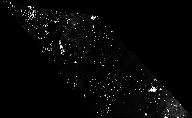
where MCD15A2.A2011185.h09v05.005.2011213154534.hdf is the name of the input HDF file, MOD_Grid_MOD15A2:Lai_1km is the data product we want, and the rather menacing string +proj=aea +lat_1=29.5 +lat_2=45.5 +lat_0=23 +lon_0=-96 +x_0=0 +y_0=0 +ellps=clrk66 +units=m +no_defs specifies the projection in Proj4 format. You can typically find the projection you want on spatialreference.org, and just copy and paste the contents of Proj4 definition (remember to surround it by quotes). The option -tr xres yres specifies the desired resolution of the output dataset (1000 by 1000 m in the case above). -of GTiff specifies the GeoTiff format to be used as as output.